Overview
Stream restoration refers to efforts undertaken to ameliorate previous activities that have diminished, impaired, or destroyed the structure and function of stream systems. Restoration generally involves the conversion of an unstable, altered, or degraded channel to its natural or pre-disturbance state while considering present and future watershed conditions. This process consists of restoring the stream’s geomorphic dimension, pattern, and profile to achieve dynamic equilibrium, and hence biological and chemical integrity. Enhancement refers to activities designed to improve an aspect of an impaired stream system, but recovery to that of the natural or pre-disturbance condition is not feasible or practical. My extension and research efforts focus on streams impacted by urban, agricultural, and mining activities.
Download stream restoration logic model (pdf)
Instream Pollutant Load Reductions @ MMSK
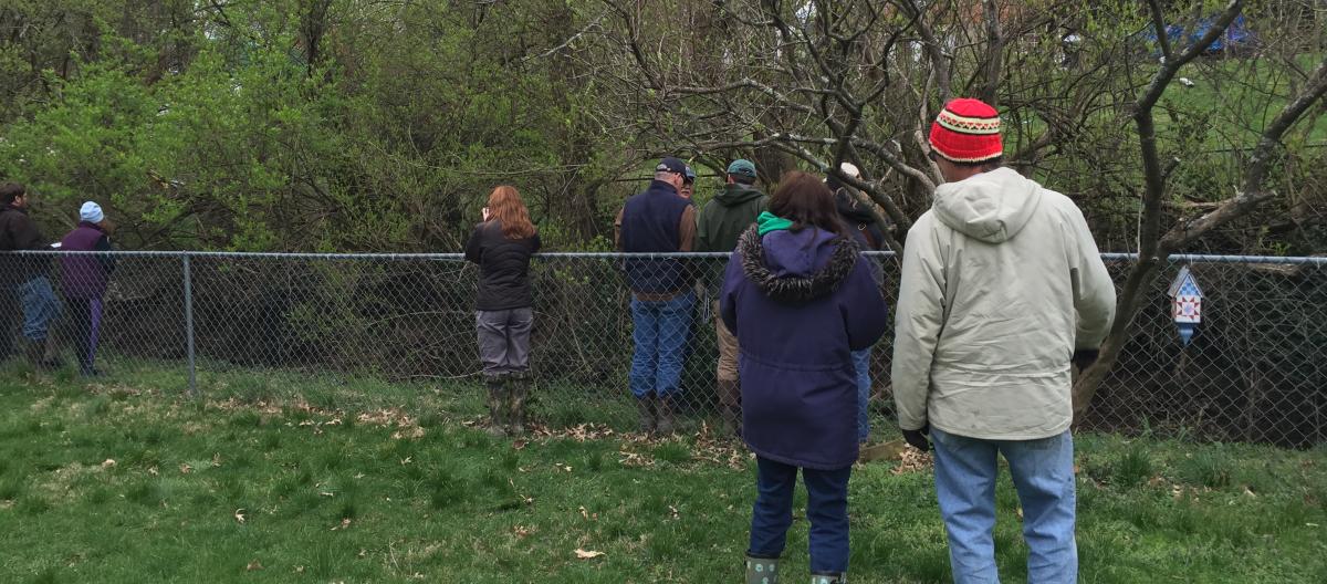
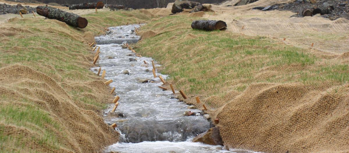
Streams draining urban lands consistently suffer from “urban stream syndrome,” which is characterized by flashy hydrology, elevated concentrations of nutrients and contaminants, altered morphology, decreased amounts of organic matter, and poor biotic richness. Urban streams are often incised, over widened, lack bed complexity, have small hyporheic zones, have narrow floodplain corridors bordered by structures and utilities, and lack woody material. Restoring urban streams is a challenging endeavor, particularly when restoration goals include water quality and habitat improvements, the top two components of the Stream Functions Pyramid. Of particular concern is nitrogen (N) and phosphorus (P) as these two constituents, in excess levels, promote eutrophication. In the U.S., eutrophication is one of the leading water quality impairments.
Stormwater best management practices focus on reducing pollutant loads from upland sources, but do not necessarily address pollutant removal in the stream itself. Restoring the hyporheic zone, particularly through the addition of woody material in the floodplain, could promote retention and processing of instream pollutants. In 2013, a nearly 950 ft of an unnamed headwater tributary (UT) to the South Elkhorn Creek at the Montessori Middle School of Kentucky (MMSK) was restored by the University of Louisville Stream Institute, Regenerative design techniques were used whereby a floodplain-wetland complex was created. The restoration resulted in a wide, wetland-like floodplain, comprised of a rock base that was overtopped with a filtration media (approximately 30% woodchips and 70% topsoil). This combination of regenerative design and woody material addition to floodplain soils, may improve the quality of downstream receiving waters indicating such stream restoration efforts may serve as a viable TMDL.
The purpose of this project is to determine the effectiveness of using regenerative design techniques coupled with a designed filter media to improve water quality of urban streams. Specific objectives of the project are to: 1) determine the effect of the MMSK stream restoration project on hydrology, 2) determine the ability of the MMSK stream restoration project to improve water quality, and 3) educate water managers, design professionals, and other stakeholders on strategies to restore urban streams and improve water quality.
Collaborators include Samuel Austen (University of Kentucky, Biosystems and Agricultural Engineering), Dr. Art Parola (University of Louisville Stream Institute), Eric Dawalt (Ridgewater, LLC), and Montessori Middle School of Kentucky.
View Instream Pollutant Load Reduction Pictures
Backyard Streams
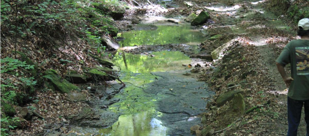
Streams are all around us. Kentucky is home to more than 92,000 miles of stream and rivers. Many times, homeowners are not sure what to do with the stream that is flowing through their back yard. Stream in urban areas are often affected by “urban stream syndrome” meaning they frequently flood, streambanks erode, invasive plants are common, and the habitat quality is poor.
Dr. Agouridis, in partnership with Amanda Gumbert (University of Kentucky, Extension Water Quality Liaison) and Christopher Sass (University of Kentucky Landscape Architecture, Assistant Professor), works to educate Kentucky citizens about watersheds and stream systems. The goal of this effort is to empower homeowners by providing them with knowledge and informational resources so they can make more informed decisions regarding the management of Kentucky’s water resources.
Download Backyard Stream Guide

Eastern Kentucky Coalfields Regional Curves
Bankfull regional curves, which relate bankfull channel dimensions (e.g. area, width, depth, discharge) to drainage area, as well as hydraulic geometry curves that use bankfull discharge as the independent variable are useful tools for assisting in the correct identification of bankfull. Regional curves are particularly helpful when assessing incised stream systems where lack of good bankfull indicators is a common and problematic occurrence. To obtain the necessary information to develop regional and hydraulic geometry curves, data must be acquired from several reference regional streams representing a wide range of drainage areas (and bankfull discharges).
Anthropogenic activities in the Eastern Kentucky Coalfields (EKC), such as current and historic mining activities and expansion of the Mountain Parkway, has resulted in a need for stream mitigation in the region. The goal of such stream restoration projects is to reduce the net loss of streams and their ecosystem services as a result of these anthropogenic impacts.
The purpose of this work was to develop regional and hydraulic geometry curves for the EKC. The specific objectives of the project were to 1) determine bankfull recurrence intervals and develop regional and hydraulic geometry curves for the EKC, 2) develop and compare regional and hydraulic geometry curves for hydrologic landscape regions (HLRs) 9, 11, and 16 in the EKC, and 3) compare these curves to theoretical values and results from other such curves developed in the U.S.
Collaborators include Ashlan Berry (University of Kentucky, Biosystems and Agricultural Engineering), Dr. Lindell Orsmbee (University of Kentucky, Kentucky Water Resources Research Institute) and Dr. Richard Warner (University of Kentucky, Biosystems and Agricultural Engineering).
University of Kentucky Spindletop Farm
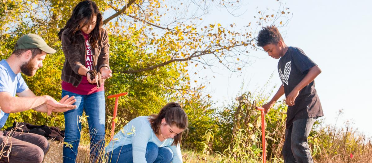
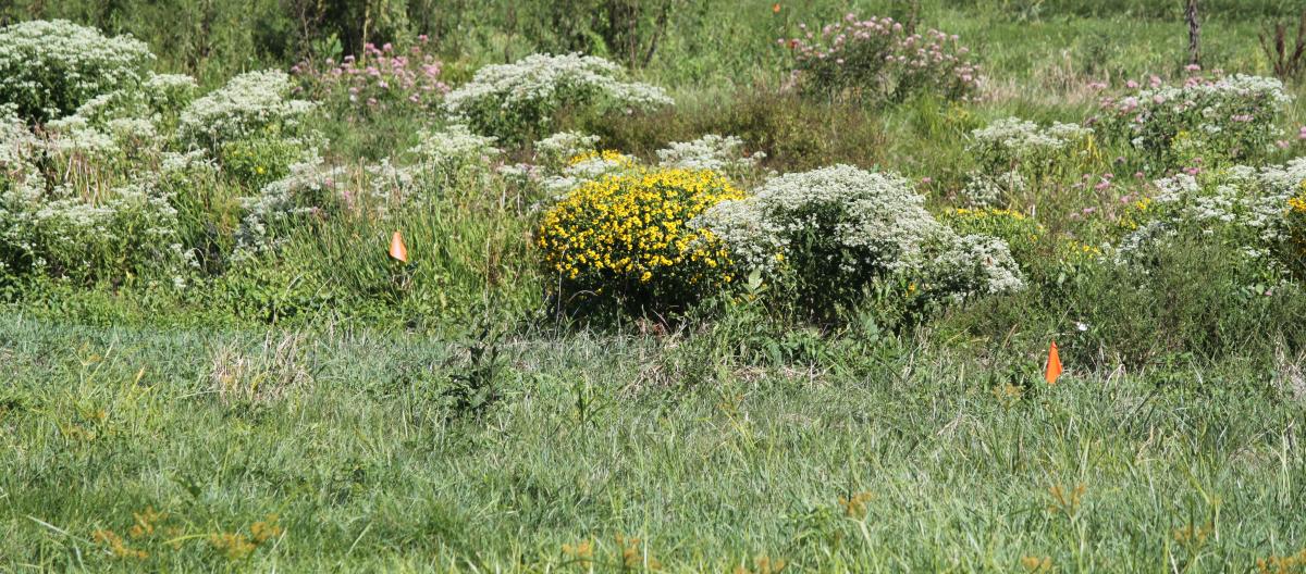
The project involved the restoration of a 550 ft section of a spring-fed channel by (1) removing an 18” temporary culvert that was installed during the construction of the Legacy Trail, (2) creating a native tallgrass prairie (~1.0 ac), (3) restoring approximately 20 ft wide and 550 ft long riparian buffer with native shrubs, herbs and flowers, and (4) creating an approximately 1,500 ft2 oxbow wetland near the confluence of the UT to Cane Run and Cane Run itself. The eight grade class from Leestown Middle School planted the riparian buffer and oxbow wetland as part of UK’s Water Week.
Collaborators include Dr. Christopher Barton (University of Kentucky, Forestry), Tyler Sanderson (University of Kentucky, Biosystems and Agricultural Engineering), Eric Dawalt (Ridgewater, LLC), Jim Hanssen (EcoGro), Tracy Farmer Institute for Sustainability and the Environment, and Whayne Supply Company.
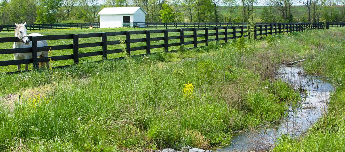
Kentucky Horse Park
The project consisted of restoring 1,775 ft of stream located on the Kentucky Horse Park. The goal of the project was to reduce streambank erosion and improve habitat, water quality, and aesthetics. Funding was provided through a 319(h) grant. The initial stream restoration design was performed by students in Dr. Agouridis’ course BAE 532/CE 542 Introduction to Stream Restoration. Stantec completed the design, Dr. Agouridis obtained the permits, and the EcoGro/Ridgewater Team constructed the project.
Collaborators include Eric Dawalt (Ridgewater, LLC), Jim Hanssen (EcoGro), Brad Redmon (EcoGro), Bret Levy (Stantec), and Sam Lee (Stantec).
View Kentucky Horse Park Pictures
University of Kentucky Maine Chance Farm
This project consisted of restoring 875 ft of a spring-fed stream. This unnamed tributary (UT) exits into another UT to the Cane Run before discharging into the Cane Run itself. The drainage area of the project reach is 0.2 mi2. Based on visual observations, the stream flows primarily during the wet season (early winter through late spring) and is dry the remainder of the year. Prior to restoration, the stream had minimal bed features (e.g. no defined riffles and pools) and sparse vegetation to limit runoff from adjacent horse pastures. The Rapid Bioassessment Protocol (RBP) score was 40, which is in the Poor category.
The stream reach underwent restoration in May of 2012. Funding was provided by the Natural Resource Conservation Service and the University of Kentucky. The project was constructed by the EcoGro/Ridgewater Team. Excess limestone rock from another nearby stream restoration project was used to construct riffles. Wood from dead trees located in nearby riparian areas was harvested and placed in the stream bed to add habitat diversity. Sod and plastic-free erosion control matting was placed along the streambanks for erosion control. The riparian buffer was planted with native wildflowers and root propagation method tree stock. By the third year post-restoration, the RBP score increased to 141, which is nearly in the highest category of Good.
The initial stream restoration design was performed by students in Dr. Agouridis’ course BAE 532/CE 542 Introduction to Stream Restoration. Dr. Agouridis completed the design, obtained the permits, provided construction oversight, and led monitoring efforts.
Collaborators include Dr. Christopher Barton (University of Kentucky, Forestry), Eric Dawalt (Ridgewater, LLC), Jim Hanssen (EcoGro), and Sam Lee (Stantec).
View Maine Chance Restoration Pictures
Guy Cove Project
Headwater stream systems provide ecosystem services such as water storage, carbon sequestration, nutrient cycling, habitat creation, and temperature modification. Surface mining often results in the loss of these ecosystem services. The development of practical stream restoration and creation techniques for post-mined lands is needed to regain lost headwater stream system value. In response, the University of Kentucky - in cooperation with a number of agencies such as the Kentucky Department of Fish and Wildlife Resources, U.S. Army Corps of Engineers, Kentucky Division of Water, U.S. Environmental Protection Agency, U.S. Fish and Wildlife Service, and the Kentucky Department for Natural Resources – led the design and construction of a headwater stream system at Guy Cove. The design was largely built on the Forestry Reclamation Approach (FRA), which encourages a non-compacted spoil medium to promote tree growth, in an effort to address concerns related to water quantity and quality as well as habitat development.
This watershed-based restoration approach included a headwater stream system comprised of ephemeral, intermittent and perennial channels, vernal ponds, a wetland-bioreactor treatment system, and a forest. The project was constructed in the fall and winter of 2008 with tree planting occurring in the late winter/early spring of 2009. Intensive monitoring was conducted five years post construction.
Collaborators include Dr. Christopher Barton (University of Kentucky, Forestry) and Dr. Richard Warner (UK Biosystems and Agricultural Engineering). Numerous students have worked on monitoring and assessing the project.
Download Guy Cove Project Flier pdf
GIS Delineation of Headwater Streams
A Cumulative Hydrologic Impact Assessment (CHIA) is an analysis of the combined effects of one or more human activities on the environment. While an activity may be independently insignificant, when combined with one or more additional sources, the cumulative impact can result in significant environmental degradation. Such information is needed so that informed decisions can be made with regards to project procession. To conduct these CHIAs, knowledge of the extent of ephemeral, intermittent and perennial streams within a large watershed, such as that of the North Fork of the Kentucky River, is required; however, field reconnaissance alone is not practical due to the large time and expense inputs such an effort would entail. Geographical Information Systems (GIS) in combination with the Water Availability Tool for Environmental Resources (WATER), which was developed by the United States Geological Survey in cooperation with the Kentucky Division of Water offers a means of developing a standardized protocol for using detailed spatial information to delineate stream types in the Appalachian Coalfields Region for use in CHIA development.
Using headwater point-of-origin data collected from Robinson Forest in eastern Kentucky along with data from three jurisdictional determinations obtained via a Freedom of Information Act request to the U.S. Army Corps of Engineers, headwater streams in the Appalachian Coalfields Region were characterized according to a set of spatial parameters. These characteristics were extrapolated using GIS to delineate headwater streams over a larger area, and the results were compared to the National Hydrography Dataset.
Collaborators include Jonathan Villines (UK Biosystems and Agricultural Engineering), Dr. Richard Warner (University of Kentucky, Biosystems and Agricultural Engineering), and Dr. Christopher Barton (University of Kentucky, Forestry).
View Delineation of Headwater Streams Pictures
Denitrification Potential in Riparian (Streamside) Buffers
Riparian or streamside buffers provide numerous benefits such as temperature modifications, filtering of runoff, nutrient cycling, streambank stabilization, and habitat provision. These ecosystem services are linked to how we manage the land. In many agricultural areas, regularly mowing riparian buffers is culturally associated with good land stewardship because mowing helps farmers maintain an orderly appearance. However, regular mowing can impair ecosystem services. The goal of this project was to measure the denitrification potential associated with mowing regimes and native grass establishment in a riparian (streamside) buffer zone.
Collaborators include Ivan Ribeiro (Federal University of Viçosa, Agricultural Engineering), Mark Coyne (University of Kentucky, Plant and Soil Science), and Amanda Gumbert (University of Kentucky, Plant and Soil Science).
Bluegrass Regional Curves
Hydraulic geometry relationships and regional curves are used in natural channel design to assist engineers, biologists, and fluvial geomorphologists in the efforts undertaken to ameliorate previous activities that have diminished, impaired or destroyed the structure and function of stream systems. Bankfull channel characteristics were assessed for 14 United States Geological Survey (USGS) gaged sites in the Inner Bluegrass and 15 USGS gaged sites in the Outer Bluegrass Regions of Kentucky. Hydraulic geometry relationships and regional curves were developed for the aforementioned regions. The resultants curves are used in the USGS’s StreamStats to estimate bankfull parameters for the Inner and Outer Bluegrass Regions of Kentucky.
Collaborators include Ruth Ann Brockman ((University of Kentucky, Biosystems and Agricultural Engineering), Dr. Lindell Ormsbee (University of Kentucky, Kentucky Water Resources Research Institute), and Dr. Stephen Workman (University of Kentucky, Biosystems and Agricultural Engineering).